-
Our mission is to enhance the livability of Baltimore County’s urban communities by protecting, restoring, and stewarding land for small parks, gardens, trails, and natural areas.
-
Our mission is to enhance the livability of Baltimore County’s urban communities by protecting, restoring, and stewarding land for small parks, gardens, trails, and natural areas.
We Protect Land...
NeighborSpace uses a custom GIS tool to select environmentally valuable sites such as stream buffers, forests and amphibian habitat.
Sites are restored with stormwater BMPs and native tree, shrub, and perennial plantings to improve water quality, reduce erosion, and clean the air.
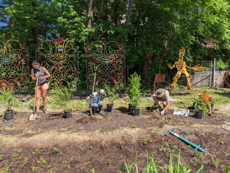
We work together with community members, volunteers, fellow nonprofits, and local experts to actively steward NeighborSpace sites.

...for people
Almost half of Baltimore County households inside the Urban-Rural Demarcation Line do not have public green space within walking distance.
NeighborSpace’s GIS tool prioritizes land that addresses local social needs such as a lack of access to open space and low home values.
NeighborSpace sites are designed and restored through a community-driven, iterative process.
We work together with our community partners to actively maintain and program our sites.
")
Where We've Been
NeighborSpace conserves 100 acres at 21 sites across all 7 Council districts. 19 of these are open to the public.
Our parks provide green space within a 10-min walk for almost 42,000 Baltimore County residents.
In FY24, NeighborSpace and its community partners hosted 35 events and volunteers contributed more than 2,000 hours of work.
Together with partners, we’ve uncovered historical research at 2 sites.
Where We're Going
NeighborSpace is drafting a strategic conservation plan with technical assistance from the National Park Service.
We are focused on restoring riparian forest buffers and building stewardship capacity at 3 sites.
A pollinator garden, edible forest, and trees are being planted at multiple sites, and we are planning for the installation of signs, benches and trails.
NeighborSpace is highlighting the history of its neighborhoods through community-driven tours and interviews.
")